Several funnel clouds have been spotted over the last few days under thunderstorm clouds, this blog looks at how they form and why they are different to tornadoes.
Over the last couple of days the UK and Ireland have been inundated with showers and thunderstorms, most days since the start of the month in some places. This is thanks to low pressure often in charge, cold air aloft and surface heating in sunny spells creating steep lapse rates (sharp drop in temperatures with height) - which allows parcels of warmed air to rise quickly and form cumulonimbus shower and storm clouds.
Some of the heavier showers and storms have brought some eerie skies, a carpet of hail, vivid lightning and some flash-flooding in places.
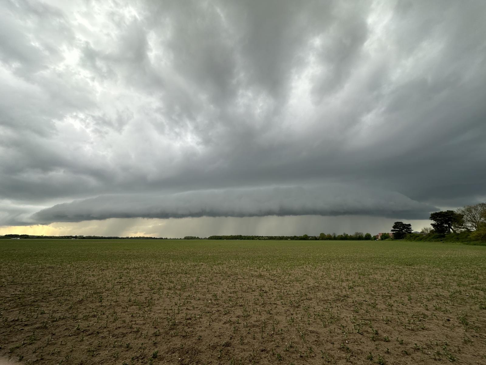
Menacing shelf cloud over Pocklington on Tuesday - uploaded by Aiden2012 to the Netweather community
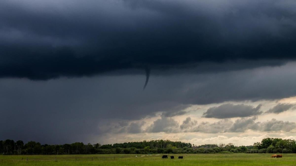
Also, over the last few days, there have been sightings of small funnel clouds too. They were captured on camera over Humberside, Bedfordshire, Lincolnshire, Suffolk and Kent.
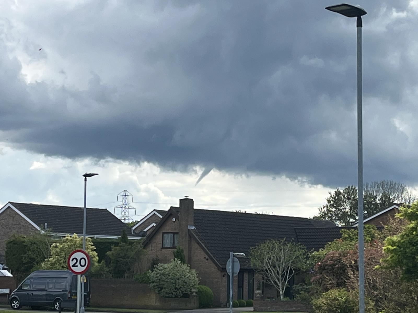 Photo uploaded to the Netweather community by Zak M
But what are funnel clouds, how do they form and how are they different to tornadoes?
The best way to define funnel clouds are condensed water droplets that form around a spinning column of air. They are a cone or needle-shaped condensation funnel lowering from a cumulonimbus or cumulus cloud base. When they make contact with the ground, they are technically a tornado or waterspout over water.
One of the funnel clouds today appeared to make contact with the ground, causing some windy mayhem in this yard in Suffolk
There is usually an updraft within showers and thunderstorms, where warm air rises. If there is a change of wind speed or direction as the air rises (wind shear), this updraft begins to rotate.
As the updraft rotates, it is stretched vertically, so the area of rotation shrinks and the spinning air speeds up. The old analogy is an ice skater twirling who pulls in her arms and starts to spin faster.
They don’t even need a thunderstorm to form, they can develop from the base of shower clouds or just cumulus clouds, but non-thunderstorm funnels rarely touch the ground.
Funnel clouds are visible if there is enough moisture being sucked in by the rotating and stretched updraft, but sometimes these are not always visible if the air is very dry.
Funnel clouds usually form when there is enough instability in the lower atmosphere to create convection or strong updrafts, i.e. the energy needed for cumulus clouds to rise and form shower clouds or thunderstorms if they become cumulonimbus clouds. There has been plenty of convective instability over the last few days, thanks to cold air aloft, low pressure at the surface and heating of the ground from sunshine to cause warmed air to rise.
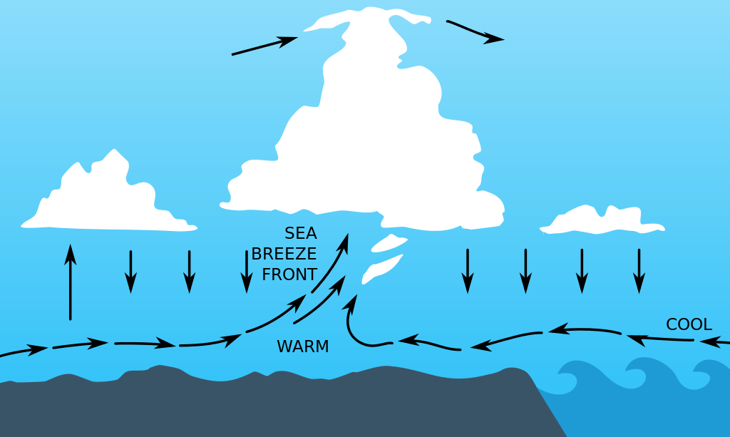
When one of these cumulus or cumulonimbus clouds interacts with a breeze convergence zone, some of the rising updrafts into the cloud can start to rotate- thanks to opposing wind directions meeting at the surface. That rotation can develop in the form of a funnel cloud which is weakly rotating.
Today saw a number of convergence zones develop, which formed from sea breeze fronts moving inland from the coast coming up against the light synoptic flow drawn around the shallow low pressure created inland over Britain as the ground is heated and the air rises. Some fairly strong instability was present, too, with thunderstorms developing in places, which indicates strong updrafts reaching great heights. One final ingredient was fairly slack winds aloft which keep cumulonimbus clouds slow-moving and rooted to the convergence zones.