Low Nelson is throwing wind and rain at the UK before it impacts mainland Spain at Easter. Wild condtions in the English Channel, and more rain and lightning here on Thursday.
A low pressure is bringing some grim weather to parts of the UK today. There is even more heavy rain, severe gales, hail, thunder and lightning with gusty winds and the risk of localised flooding. All as the UK prepares for the Easter weekend and holiday travel.
‘the extensive and deep storm Nelson, named by AEMET, will continue to focus on the environment of the British Isles.’ Spanish Met. service
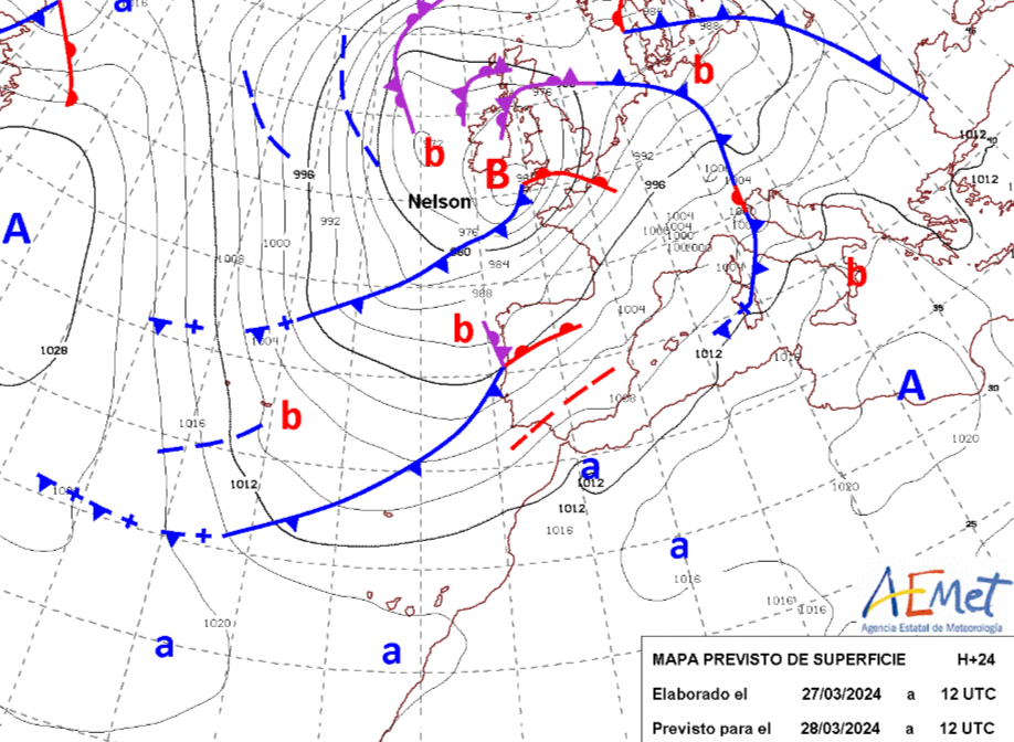
AEMET named this low pressure due to the impacts of heavy rain (widespread rain, with intense and persistent rainfall) for Holy Week, arriving at a significant time for mainland Spain. Many of us in the UK are still at work and school on Thursday, but some people will be setting off for the Easter break. Could the grim conditions in southern England have warranted a “Storm Kathleen”? Does it matter? We can just call it Nelson but the UK Met Office tends not to mention storm names when it’s not Ireland, UK or the Netherlands doing the naming. Even, when its centre is having a right stomp across England today. You have to be in the right gang. So France or, as in this case, Spain are part of the SW naming group, not our western one. Once a national Met. service has named a low, then others don't.
 Today's forecast includes thundery showers, high gusts and gales, even severe gales, through the English Channel. It might feel like a storm if you brave a stroll along the seafront on the south coast today.
“Strong winds may lead to hazardous conditions and bring some disruption.” Met Office wind warning
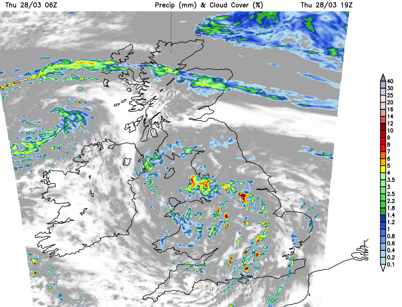
It’s a complex setup. The overnight low that brought snow to Dartmoor and the Welsh mountains is drenching all of Northern Ireland on Thursday morning with wintriness along the border.
Eastern counties of Northern Ireland have another yellow rain warning.
“Heavy rain may bring impacts to travel and infrastructure at times during Thursday, and at first Friday.”
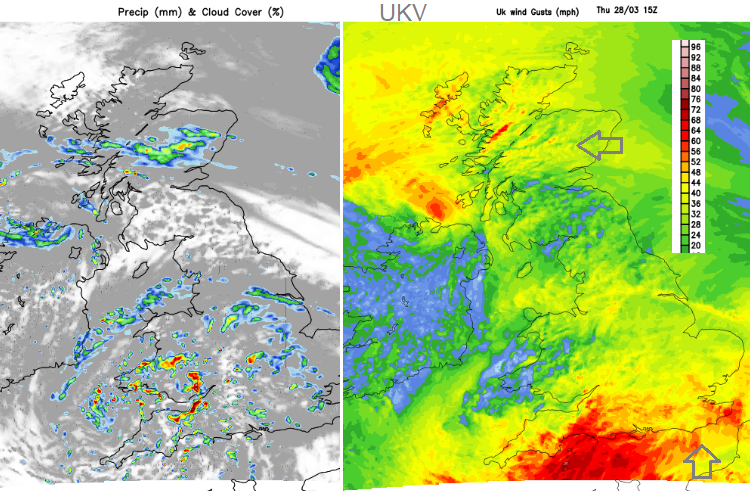
Northern Scotland starts brighter but a band of rain and hill sleet will edge northwards in a brisk cool easterly wind. Strong lee gusts continue for western Scotland.
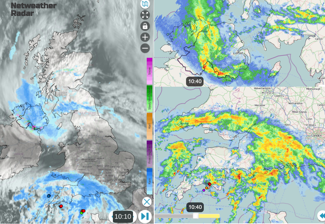
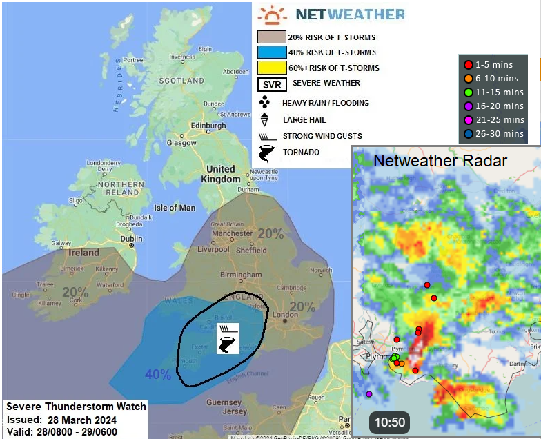
Then we have the main centre of Nelson impacting SW Britain with rain and hill sleet. Sferics are appearing on the radar image showing thundery showers. These will bring the risk of hail, torrential downpours and localised flooding.
The Convective forecast for Thursday 28th includes
“Heavy showers and scattered thunderstorms will spread NE across S. Ireland, England and Wales through the day…SW and CS England along with S Wales will have the greatest risk of a thunderstorm, surface heating in sunny spells will likely increase the risk as colder air aloft and increased forcing for ascent moves in from the SW…convective downdrafts could also produce strong and perhaps isolated damaging gusts of 60-70mph here.”
There will be strong southerly winds for Dorset and Hampshire, and after lunch, a strong to gale force SW wind for south Devon edging towards the Isle of Wight for Thursday evening commute as the long weekend begins.
The bands of rain edge northwards through Britain as clusters of heavy showers spread over the West Country and Wales today. By late afternoon there will be reaching over much of Southern Britain but with brighter gaps in between. Northern Ireland will brighten up as the heavy showers reach northern England this evening.
Ongoing risk of heavy downpours, sudden gusts, poor visibility and spray on the roads for Thursday evening.
It will be windy this evening for SE Britain, as strong and gusty SW winds affect London and the Home Counties, the M25 and London airports for those taking off or arriving at the start of their Easter holidays. Overnight, there will be more clear spells and temperatures falling away. So frost is possible and for Northern Ireland, patchy fog too.
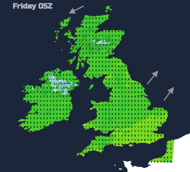
Good Friday won’t have as many heavy showers, nor the strong winds but it will still be a mixed day with occasionally hefty downpours and a freshening SW wind. There will be a slight overall improvement through Easter weekend but still with showers to catch you out,